Land Use and Urban Morphology
Exploring land-use and urban morphology in Southern Brazil using accessibility and centrality measures
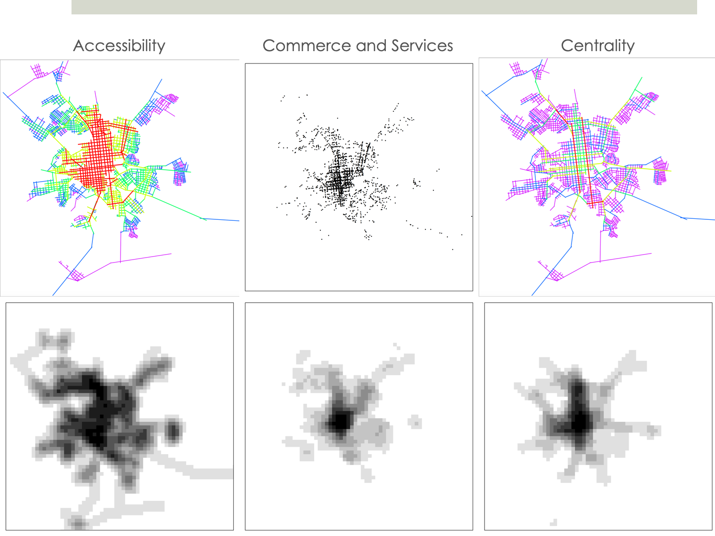
Comprehensive land use data of Brazilian cities was not available from reliable sources until the 2010 Census (IBGE 2010), when the CNEFE (National Cadastre of Addresses for Statistical Purposes) dataset was released. Land use data are traditionally collected at local level and for specific purposes, by initiative of local authorities or institutions. Brazil is administratively divided into 27 states and 5,570 municipalities, with strong regional disparities between them. Few of those local administrations collect land use data or do it using different methodologies and make it available in different formats. The lack of standards was a major issue in comparative studies. In contrast, the CNEFE dataset contains land-use information about each individual address in the country, collected for the first time in Brazil in national scale by the Brazilian Institute of Geography and Statistics (IBGE). This study explores the use of the CNEFE dataset for the analysis of the relationship between land use distribution and urban morphological structure, represented by measures of accessibility and centrality.
Keywords: Land use; Accessibility; Centrality; Southern Brazilian cities.
Publications
This research was presented in the GISRUK Conference 2016, which took place at the University of Greenwich, London, UK.
extended abstract | presentation